Restore Karakung
WHY ?
Why, in all these years are there no markers or signs that illustrate the history of the mills?
Why, in all these years is there nothing that tells of Israel Whelan and the war of 1812?
Why, in all these years, is there nothing that relates the history of Dennis Kelly and the first Irish immigrants.
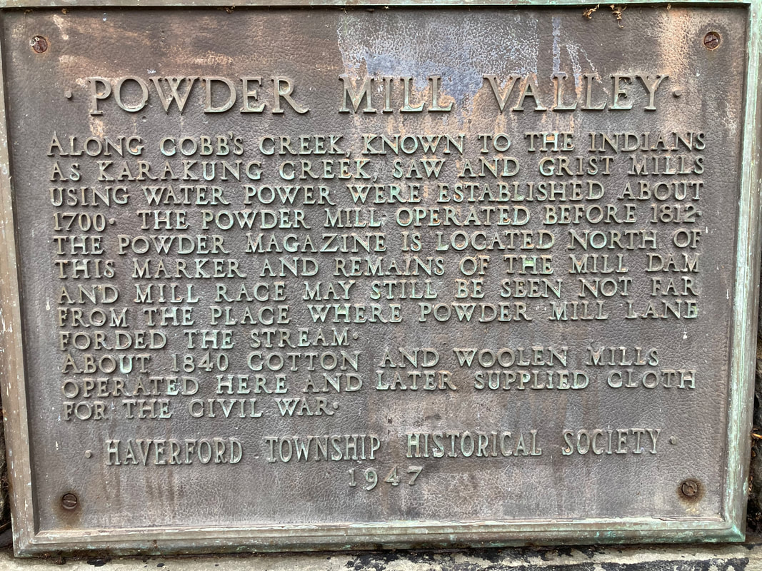
Why, in all these years has nothing been done to restore and preserve the Powder House, the last vestige of the mill industry that created this township.
The information and the images are readily available. Why are they not made known to the public?
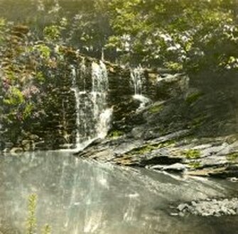
The dam
|
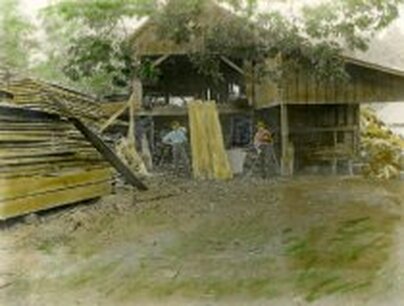
The Saw Mill
|
Make Karakung
(The Cradle of Haverford Township)
a
Township Park
CONTACT YOUR COMMISSIONER
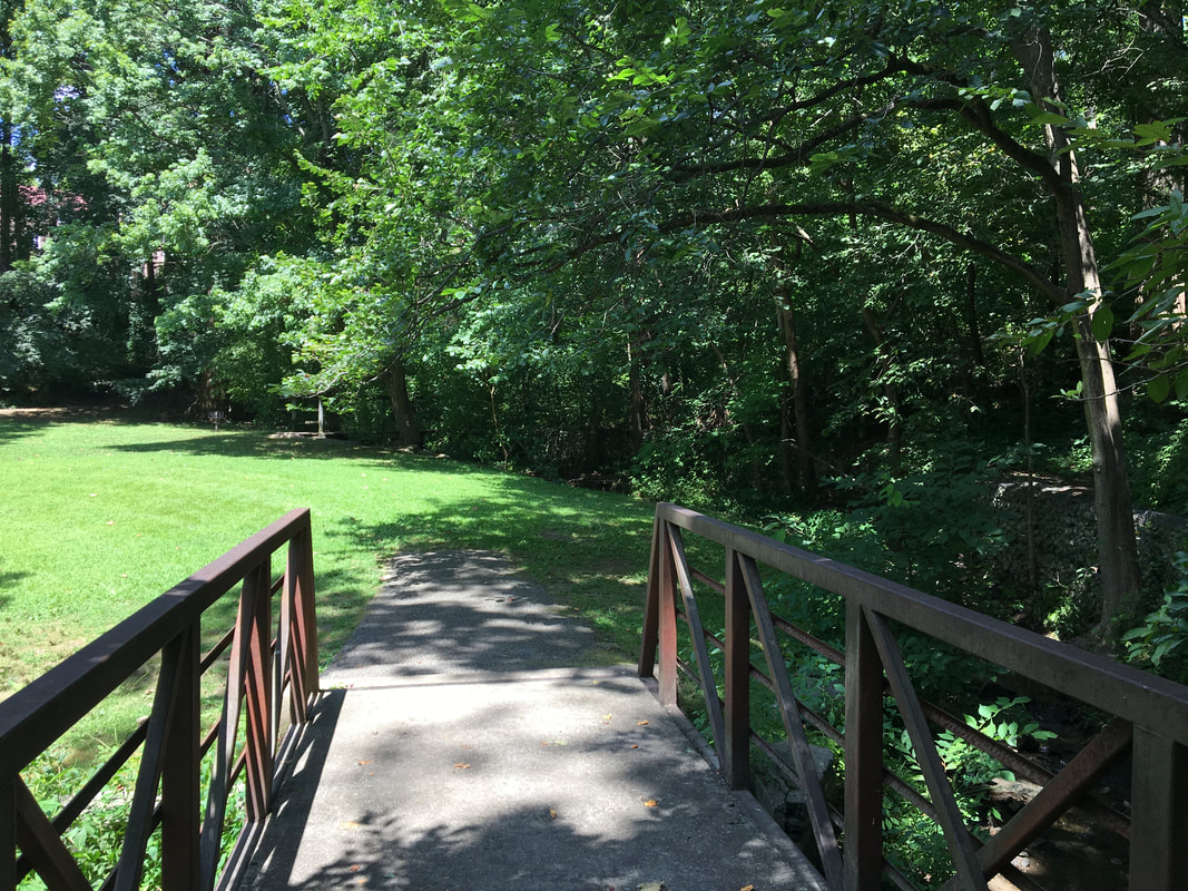
Karakung Creek and Karakung Drive have long been neglected. Karakung is the cradle of Haverford Township. Its mills and factories are an essential part of local and national history, yet there are no signs or markers that relate its remarkable history.
The creek and its borders need to be made an official park.
There needs to be a comprehensive environmental plan for the stretch between Manoa Road and Haverford Road. The creek bed needs to be cleared of invasives. We need a secure pathway along the creek and we need to to preserve the last remnant of the mills. the Powder House.
Save the history and beauty of Karakung Creek
***
3 Objectives
***
***
3 Objectives
***
________________________________________________________________________________________________________________________________________________________________________
1. Create an ecological and historical plan.
2. Preserve the Powder House.
3. Set out a safe path from
Haverford Road to Manoa Road.
A RESTORATION
will require
The State, the County and the Township
will require
The State, the County and the Township
Clearing the Creek Bank
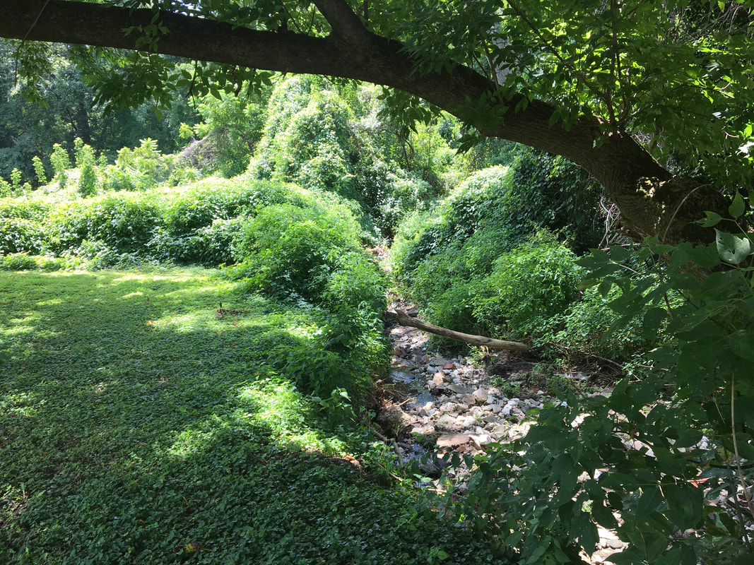
Before Covid a group of neighbors, on their own initiative, volunteered to clear the invasives, including knotweed, porcelain vine and dead shrubs along Karakung at the bottom of Mill Road. When the volunteers finished the township finally took some action by applying herbicides to the cleared area.
The township, after prompting, also planted trees. The township was presented with the historical documents that indicated that willow trees were the historical plantings. The old mills used the willow branches to make charcoal. The township planted several types of trees, no willows were included.
We have also asked for benches at the base of Mill Road and for the planting of native flowers. There has been no response to these requests.
TREE PLANTING
Since Covid, the township began working on clearing some of the areas along Karakung with no acknowledgement of those who inaugurated the work and whose work prompted the township's action. Part of the township's long needed intervention included the planting of trees. But, here again, they paid little attention to history. At a Commissioners Meeting. the document was read that clearly illustrates that willow trees were planted along the creek. Yet, willow trees were not included in the township's plan. This may seem an irrelevant observation, but it is indicative of the township's lack of historic interest and research.
(It is also noteworthy that willows are advised for preservation against creek bank erosion.)
-----
"Along the banks grew massive, gnarled willows and other trees which sought the nearby water, while the sloping banks were adorned with masses of glowing ferns and patches of the yellow celandine. At this section the lane passes through a more open space, the sides of the road being lined with old willow trees, as were also the adjoining fields. These trees had been planted in every available space for rapid growth. They were annually trimmed and the wood used for the purpose of making charcoal. "
John W. Eckfeldt’s 1917 “Cobb’s Creek in the Days of the Early Powder Mills”
Before the clearing.
|
After the clearing.
|
________________________________________________________________________________________________________________________________________________________________________
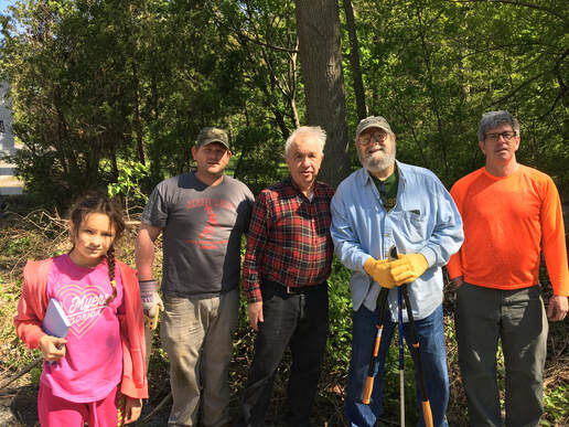
A few of the many volunteers.
Clearing the green space at the base of Mill Road by local residents. (Not the township.)
The History of Karakung
The source of Karakung (and subsequently Cobb's Creek) is a spring that rises on the property just off College Avenue west of the tracks.
The history of Karakung is the history of the mills and the first industries of Haverford Township. The history of the mills is on its own page on this site. A portion is repeated here.
Please see:
http://iliveinharford.com/the-mills.html
Please see:
http://iliveinharford.com/the-mills.html
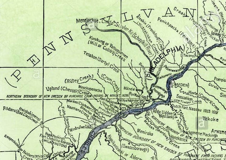
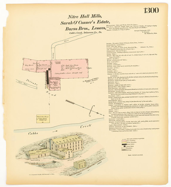
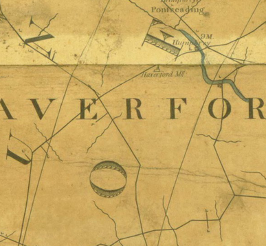
This early map of New Sweden is the first to show the name "Karkakung." It seems that the creek was also called "Vattuquarnen." "Vatten" is Swedish for "water." The meaning of "quarnen" is unknown. Look just below the "S" of Pennsylvania.
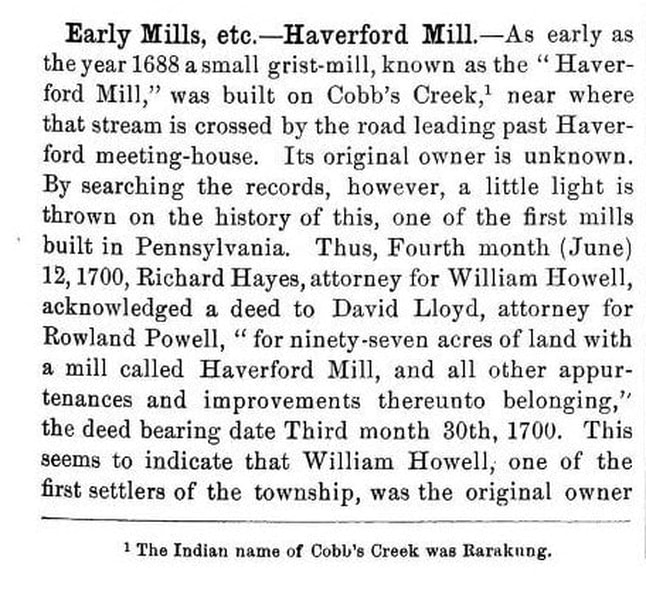
On March 1st, 1681, William Penn received his charter for “Pennsilvania” from King Charles II. A year later, the Ship “Welcome” sailed from Deal, England, departing 31 August 1682, and arrived at the mouth of the Delaware River (New Castle) on 27 October 1682. In that same year the Welsh set out the boundaries of their “barony.” The first Welsh mill along , Karakung Creek, may have been built around the year 1688. A 19th century account offers the following:
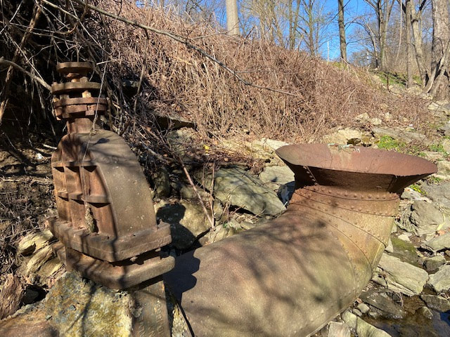
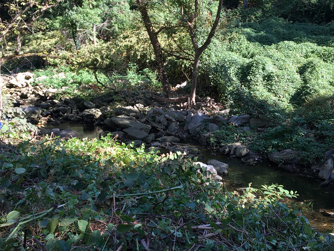
Ruins of the Mills -
Where are their historical markers?
Why is their history silent?
Intake from the damn pond to the mill. Ruins of the damn.
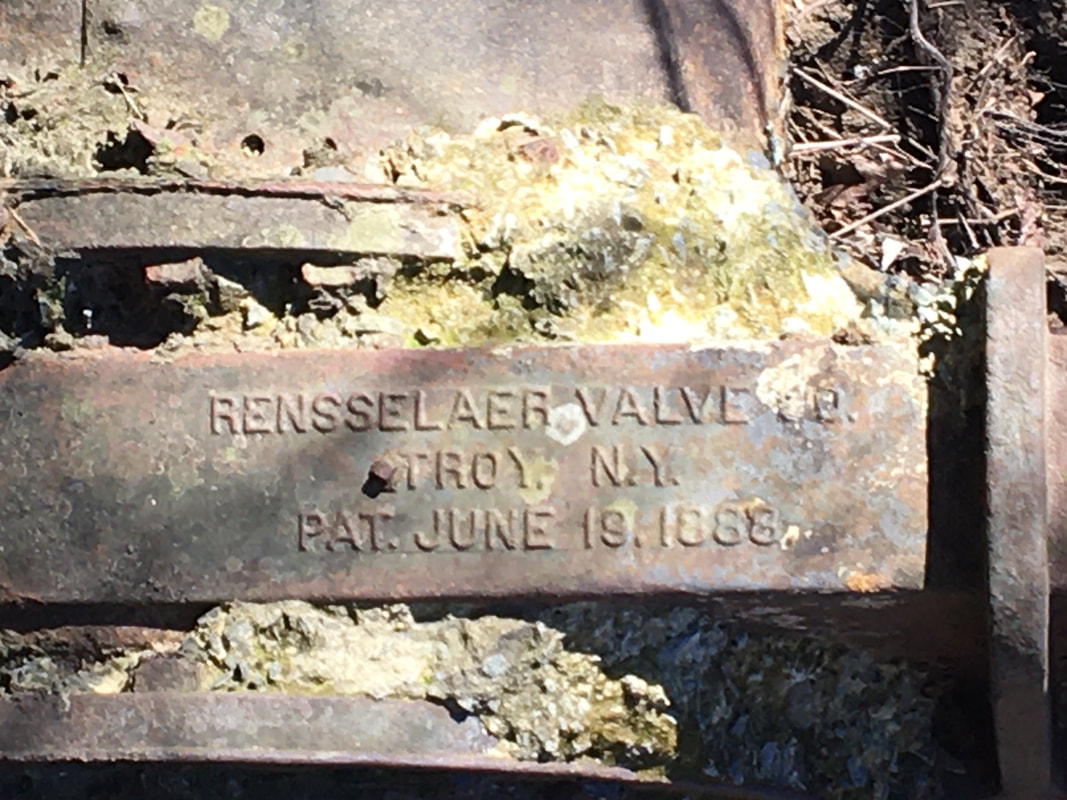
The plate reads June 18, 1888.
These ruins are just opposite Haverford Mountain (Star Rock.)
The plate reads June 18, 1888.
These ruins are just opposite Haverford Mountain (Star Rock.)
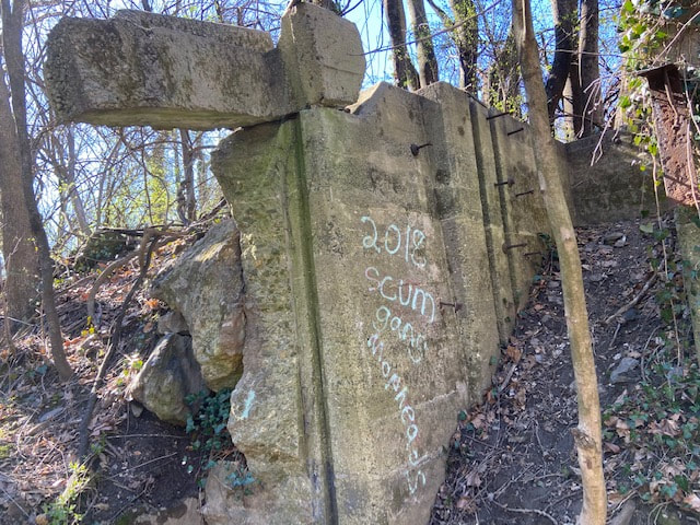
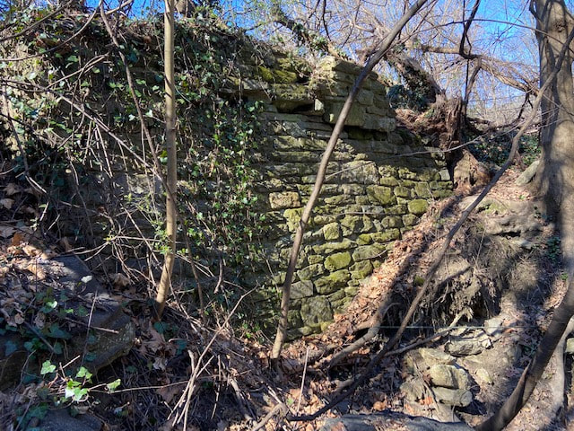
PreserveThe Powder House
The Powder House, or the Powder Magazine, is all that remains of the prosperous mills that once lined Karakung Creek. The structure sits on SEPTA property and is too close to the rails. The Powder House needs to be moved to the open space just across Karakung Drive where is will be accessible. This building is a precious historical monument. It needs to be preserved and be honored as a significant part of our history.
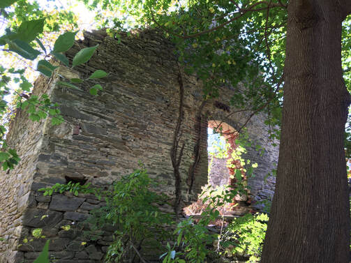
The ruins of the historic POWDER HOUSE are lost behind encroaching vines. Today few know that the building exists. It is hidden behind encroaching vines and weeds. If nothing else, the township, with SEPTA, needs to clear the area.
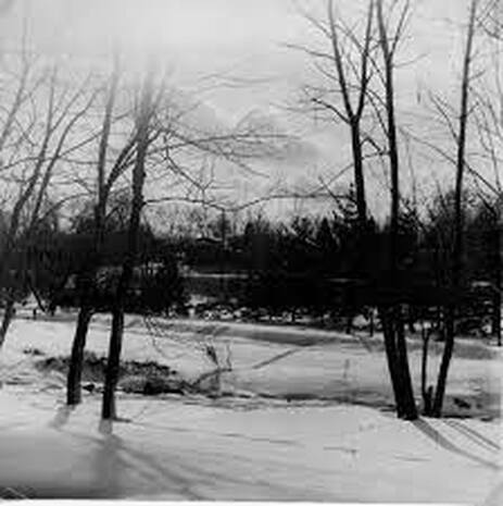
Kelley's Pond
For those of a certain age Karakung gave us Kelley's Pond. The pond, located opposite the Powder House, was our winter ice skating center. For evening skating, parents turned on the headlights of their cars. The pond was filled in at the time the Skatium was built and a chapter of childhood memories came to a close.
For those of a certain age Karakung gave us Kelley's Pond. The pond, located opposite the Powder House, was our winter ice skating center. For evening skating, parents turned on the headlights of their cars. The pond was filled in at the time the Skatium was built and a chapter of childhood memories came to a close.
HIDDEN FLORA
HAVERFORD MOUNTAIN
Yes, the correct name is Haverford Mountain. (The origin of the name "Star Rock" is uncertain) Climb to the top to experience several priceless examples of native species. These plants are in serious danger of being overrun by the knotweed that is making its way up the rocks.
John W. Eckfeldt’s 1917 “Cobb’s Creek in the Days of the Early Powder Mills” notes, “A short distance up the creek, through a very beautiful ravine lined with noble trees, were located the old grist and sawmills, situated at the bend of the road at the foot of "Haverford Mountain" on the same site where the railroad power house now stands. “
Haverford Mountain's Native Plants
NATIVE PLANTS AND FLOWERS
on
Haverford Mountain
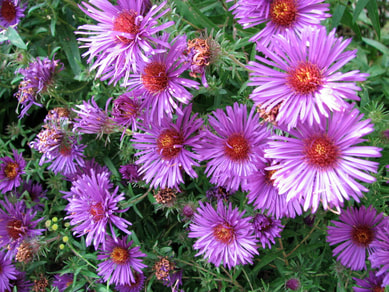 Asters
With the eradication of invasive the next step is the re-introduction of NATIVE PLANTS and FLOWERS
|
Penn State Extension offers an extensive list of our Pennsylvania flora that would thrive along the creek.
https://extension.psu.edu/pennsylvania-native-plants-for-the-perennial-garden As does the Pennsylvania Department of Conservation and Natural Resources.
www.dcnr.pa.gov/Conservation/WildPlants/LandscapingwithNativePlants/Pages/default.aspx |
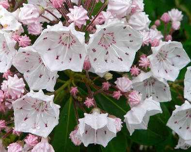
Pennylvania State Flower
Mountain Laurel
|
Trees and Shrubs of Karakung
A catalog of the trees and shrubs along the creek is in progress.
Click in the link below.
***
KARAKUNG CATALOG
of
Trees and Shrubs
Volunteer catalogers are needed. Please submit your photos.
Karakung needs a caring hand.
The Karakung Drive area, once known as “Echo Hollow,” deserves far more attention than it has received. There are not only practical considerations but historic and aesthetic features that seek attention. In the 19th century the creek was lined with willow trees. Accounts of the time speak of the natural beauty of the valley. An early map of 1808 distinguishes what was called Haverford Mountain. Another account speaks of a rock that could be moved without being dislodged. John W. Eckfeldt’s 1917 “Cobbs Creek in the Days of the Old Powder Mills,” illustrates page after page the natural beauty of the valley.
*
"Along the banks grew massive gnarled willows and other trees which sought the nearby water, while the sloping banks were adorned with masses of glowing ferns and patches of the yellow celandine. At this section the lane passes through a more open space, the sides of the road being lined with old willow trees, as were also the adjoining fields. These trees had been planted in every available space for rapid growth. They were annually trimmed and the wood used for the purpose of making charcoal. "
---
The road leading north winds through the rocky valley among the hills and several locations have been the scene of some interesting incidents. Through this region at the summit of the hill there existed a large deposit of glacial rocks, many of great size. At the highest altitude one rock weighing many tons was so evenly balanced that the slightest effort could rotate it several degrees, yet it was impossible to dislodge it from its natural position. The attractive mill pond is situated here, and fortunately this has been preserved and is now used as a reservoir for the power company. The banks are rocky and the slopes are finely wooded.
*
When I was a kid, we played along Karakung Creek and skated on the now gone “Kelly’s Pond.” In those days we also had the ruins of the 1907 amusement park and the mills to play around. Climbing the rocks was a favorite pastime. Now, the ruins are gone, the pond was filled in and getting to the rocks is almost impossible. The creek valley is now overgrown. The growth is weeds and brush. Dead and fallen trees cover the banks. The current decadence and decay of the natural growths along the creek obstruct the elegant beauty of the rock outcroppings and the creek borders that form the valley. The remaining ruin of one of the mills is concealed by growths.
On the practical side, runners and walkers have no safe path. The Boy Scouts cut a trail along part of one side of the drive but the trail is not easily negotiable. Children going to the pool in summer and students going to school in winter have no traffic clear path or lane. Joggers and walkers must avoid cars and trucks. There is no clear way for them.
Environmental factors also need to be considered. Creeks and streams that are the arteries of watersheds should be lined with vibrant tree growth. The roots and under-structures of the trees serve not only as girders of the ground soil but as significant filters of elements that would otherwise pollute the waterways.
To restore the natural beauty of Karakung will require time and funding. Its amelioration needs to be seriously considered. The drive should be a vibrant park for the community as it once was.
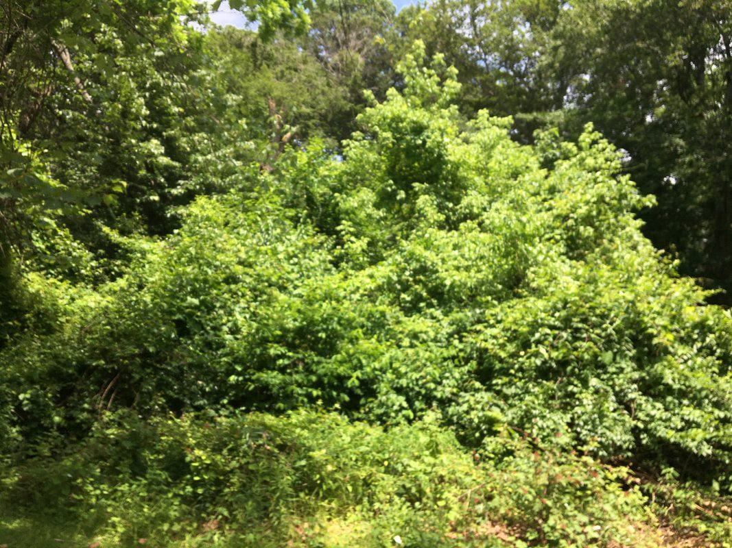
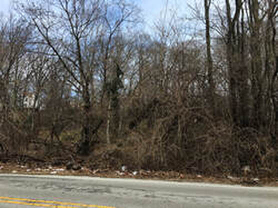
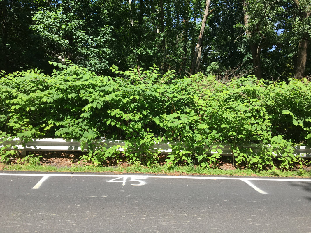
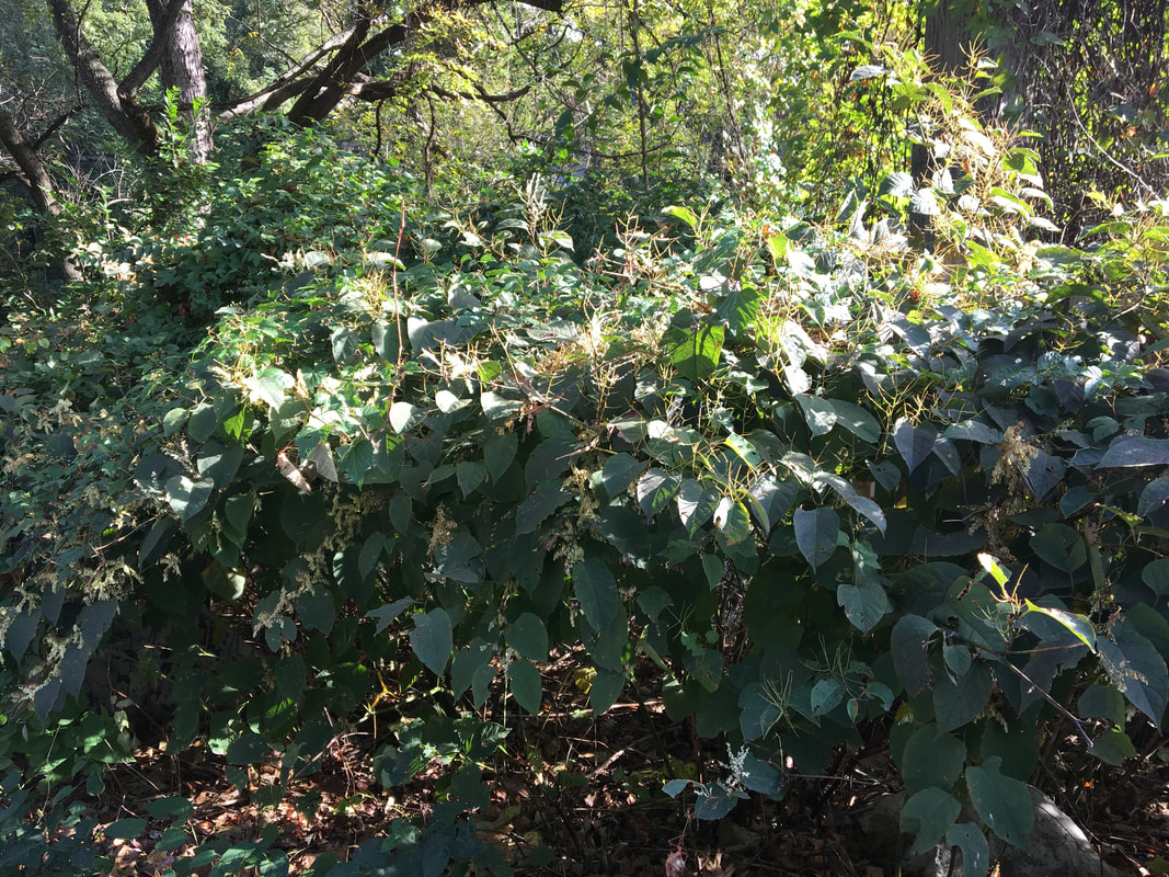
KNOTWEED ELIMINATION
This hedge of knotweed obstructs the view of Karakung Creek.
How easily could Township maintenance clear it away?
How easily could Township maintenance clear it away?
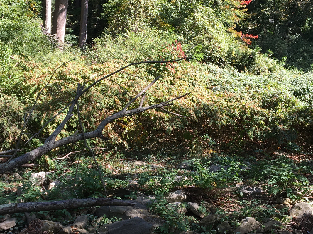
The effects of uncontrolled
knotweed.
The excerpts below are taken from this extensive article on knotweed.
https://slate.com/technology/2019/05/japanese-knotweed-invasive-plants.html
First, knotweed grows so densely that virtually no sunlight hits the ground in a knotweed forest. In the massive Coos County patch there were no more than two other plant species growing in the knotweed’s shadow. That, in turn, reduces the number of bugs that might live in that landscape. Where there are fewer bugs there are fewer birds, and so on.
Second, and relatedly, new trees can’t grow in a knotweed monoculture, which is very bad for streams. In a native New England forest, dead branches play an indispensable role in shaping streams. Woody debris feeds bugs who feed trout. Logs create eddies and pools, which enhance stream habitats and provide places for sediment to collect, improving water quality downstream. Fewer trees, fewer pools, fewer bugs, fewer trout.
In knotweed colonies, the ground was barren of organic material, which increased the likelihood of soil erosion during rainstorms. Sure enough, when Hammer looked at the boulders and cobbles in streambeds near knotweed growth, he found that rocks downstream from the plant were more likely to be coated in silt. That’s bad for fish and invertebrates who use the clean rocks for nesting, he said, and bad for humans whose water, down the line, may be carrying chemicals from fertilized soil that makes its way into the stream.
The article goes on to note how along the Bronx River in New York “after nearly two decades of management, this is a place where the Parks Department has beaten back one of its biggest foes. Once, knotweed so thrived here that in high summer the asphalt paths became tunnels, dark at noon beneath canes of knotweed bending toward the light. Volunteers spaced 10 feet apart used to march through the forest swinging machetes in each hand. … On the river’s east bank, years of cutting, picking, and spraying have in places reduced the plant to a few wayward, scraggly stalks. … Groups of high schoolers filled the bed of a pickup truck with contractor bags of knotweed. The conservation crew leader told me she is here five days a week, and knotweed takes up 85 percent of her time, but she can finally see the river.
These clearings in the Bronx River Forest are a testament to the enormous human effort required to tame the plant. Here in one of the most densely populated neighborhoods of America’s biggest, richest city, we have broken knotweed’s hold."
WILDLIFE
Knotweed disturbs the wildlife cycle. It causes a decrease in insects and other species that provide food for larger animals. Karakung Creek is home to an assortment of birds, including the Great Blue Heron.
PARK COMPARISONS
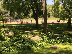
How Lower Merion Maintains its Parks
Bala Cynwyn Playground just off Belmont Avenue offers a perfect example of a creek bed that is well maintained by Lower Merion Township. Native plants thrive and wild flowers grow among the mosses. The adjacent baseball field completes the scene. A restored Karakung would surpass it.
Bala Cynwyd Playground
|
|
|
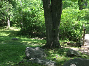
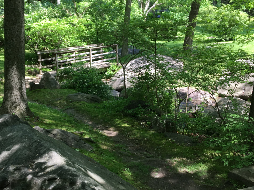
WYNNEWOOD PARK
The creek at Wynnewood Park, Lower Merion. no invasives. a row of lovely bridges. a playground.
Compare the creek in Lower Merion above with the same creek on the Haverford Township side. In Haverford Township the creek is all but completely obscured by invasives.
VOLUNTEERS
Volunteers accomplished much in Summer 2019 before Covid.
Now, we need the public voice to save the creek and the Powder House.
Past Work
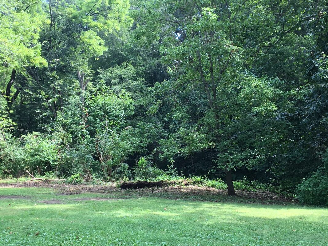
Compare: These are the same places.
BEFORE
|
AFTER
|