Oakmont
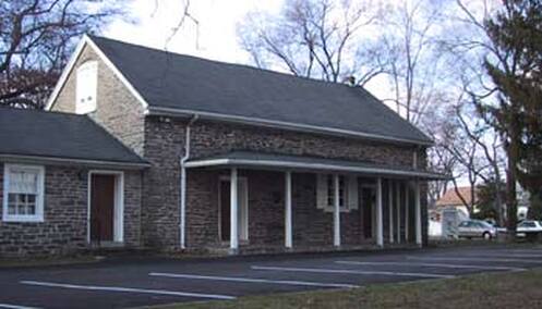
The earliest building in what will become Oakmont Is the Haverford Friends Meeting House. The Meeting House sits at the top of the highest rise in the area and even today offers view over the valley that descends to Karakung Creek.
A passage from the court records of 1696 offers and early mention of the Meeting House.
The Grand Jury made Returne of A Roade way laid oute by them (viz) Chester County May the Eight 1696: Laid oute
by the Grand Jury a Roade from David Merrideths Plantation
To Havorfoord meeting house by virtue of an order of Court beareing Date at A Court held the 10th : 11 th : 12 th : Dayes of
December 1695 att Chester as followeth : Eadnor Begining Att David Merrideths Plantation Att A small Red oake
marked with five knoches by Stephen Bevins Plantation the
plantation on the Eight hand Thence throw Reece Thomas and Peter Edwards land To A Red oake marked with five knoches
:
Havorfoord : Thence Throw Morris Lewellins Land Thence Thorow Thomas Eeese Land Between To Cornfields Thence
Thorow George Painters Land Thence Thorow Rachell Ellises
Land Thence Thorow Morris Lewellins land the house on
the left hand straite from Thence to the Bridge one the Run that comes from Reese Ruthero his house on the left hand Thence Thorow John Bevins land Downe to Havorfoord mill
Thence up to Havorfoord meeting House : Subscribed by us the fforesaid Grand Jury : Wa : Martin foreman
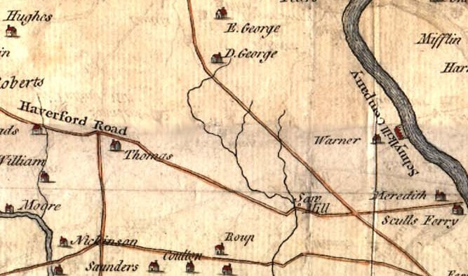
The Scull and Heap map of 1753 shows the area above what was then the Haverford Road. The Saw Mill appears at the base of today's Mill Road which seems to have been connected with Haverford Road. Curiously, this map does not indicate the Quaker Meeting House.
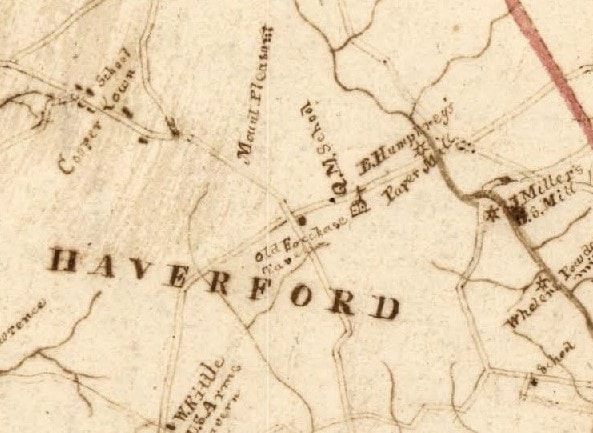
In 1816 The Melish Whiteside map clearly indicates the Quaker Meeting House and school. The Coopertown School (The Federal School) appears in the upper left. To the lower right is Jonathan Miller's grist mill (Harford Hall). Humphrey's Paper Mill is at the point of today's bridge between Eagle Road and Wynnewood Road. Oakmont was called Mount Pleasant, certainly because of its pleasant elevation.
Dennis Kelly's Saint Denis Church founded in 1825 for the Irish workers at his mills.
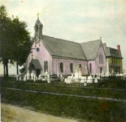
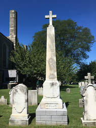
The tall cross topped monument in the photo above is the grave of Dennis Kelly. The rectory. seen behind the original church. was designed by the prominent Philadelphia architect Edwin Forrest Durang who also designed Good Counsel in Bryn Mawr and the Trocadero in Philadelphia. There is a charming story connected to rectory. It seems that a lovely young woman appeared at the window of the earlier rectory. Durant was captivated and the soon married. Durang kept the windowsill where he first saw her in his office for the rest of his career.
|
|
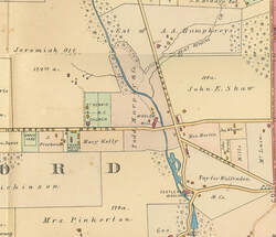
in 1875 St.Dennis Church figures clearly. Oakmont is the farm of Mrs. M Ott. Oakmont carries the name "Ott's Valley."
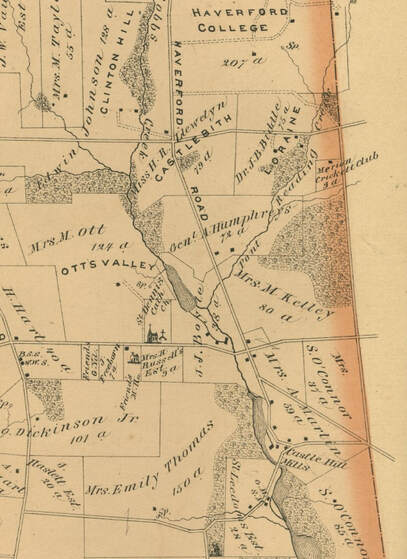
By 1902 Mrs. Ott's place has passed to Jeremiah Ott Todd, Murphy and Company are operating a wool mill. Eagle Road is still known as the Haverford and Merion Road.
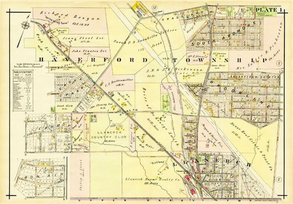
Atlas of Properties on Main Line Pennsylvania Railroad from
Overbrook to Paoli 1920.
The last map to show the farms which will be sold to the railroad land development agents.
Overbrook to Paoli 1920.
The last map to show the farms which will be sold to the railroad land development agents.
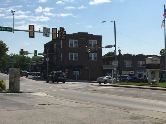
Oakmont or South Ardmore
What is the correct name of the area at the intersection of Eagle Road and Darby Road?
Some recall that they lived in South Ardmore, others that the area is Oakmont. Maps from the The correct name belongs to personal recollection.
Some recall that they lived in South Ardmore, others that the area is Oakmont. Maps from the The correct name belongs to personal recollection.
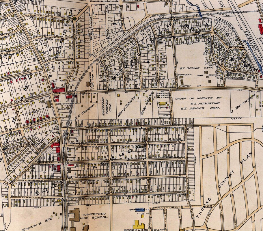
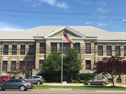
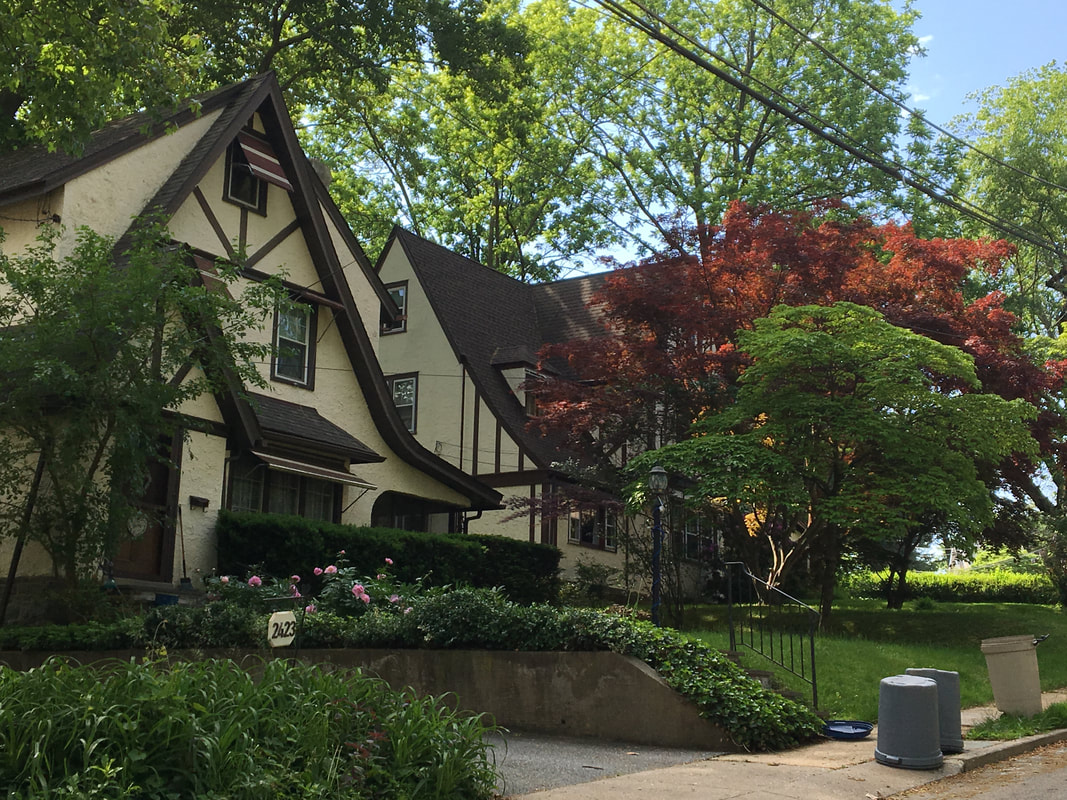
By 1929 we begin to recognize the neighborhood as we know it today. The housing tracts, developed by the Philadelphia and Western and the train lines surround the community and provide transportation to the city. Darby Road is still called Coopertown Road. The Haverford High School was roughly in the place of the current Oakmont School (1911) The mills that created the livelihood of the early residents are gone.
Oakmont Fire C0mpany (waiting for informati0n)
The Oakmont Fire Company records its opening date as December 18, 1912
9
1911
The Oakmont Home
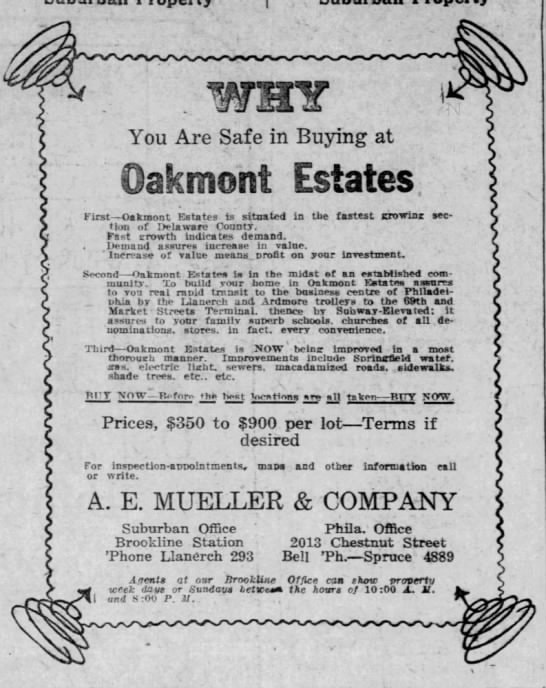
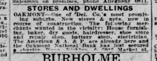
December 6, 1925 An appeal for merchants to settle in Oakmont.
June 23, 1923
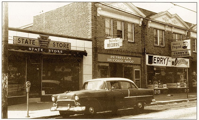
Oakmont Businesses
An early notice appeals to merchants and artisans to establish their businesses in the new Oakmont development.
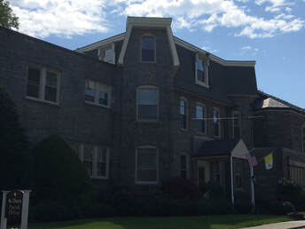
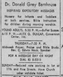
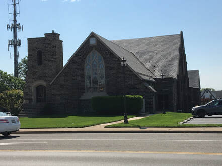
Those of a longer memory will recall when the current Grace Chapel was the center of anti-Catholic sentiment. The sign outside Dunlap's church read "Conversion Center for Roman Catholic priests, nuns and whosoever wills." At one point in the late forties a cross was burned in what was called the Police Field, the site of the current Skatium.
Today's Grace Chapel notes that its history is distinct from Dunlap. Grace Chapel has been in existence since 1908. It was started as a Sunday School for the area. The church was incorporated in 1909 and the cornerstone for the building is dated 1914. Last fall was Grace Chapel's 110th anniversary.
|
|
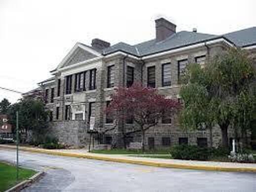
The Oakmont School
The balanced architecture of the Oakmont School, perhaps the most elegant of the four original schools that indluded Brookline, Llanerch and the demolished Manoa.