Manoa
Information on Manoa would be most helpful to this site.
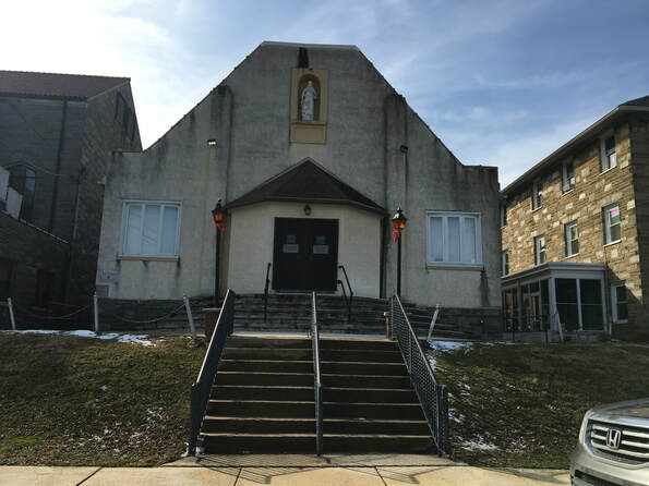
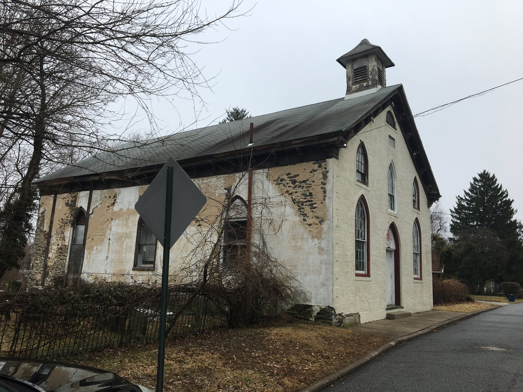
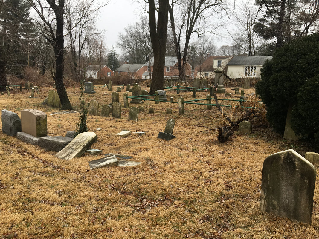
Manoa has almost no trace in buildings of its history. The Manoa post office is long gone. The Manoa schools and hospitals of the last century have long vanished. The Bethesda Church still stands along side its cemetery but the building is in great disrepair. The one building that may remain from the more recent past is the original church of The Sacred Heart just off Manoa Road. But this building has been sadly re-purposed with no consideration to its history. Manoa appears to be one of the settlements of the early 1800's. Finding specific information has been difficult. The origin of the name Manoa seems to derive from the biblical father of Samson, Manoah. When this name was applied to this segment of Harford has not been determined.
The 1848 Ashford Map indicates the "Spread Eagle Tavern" with the PO (Post Office) designation, at the intersection of Church Road (today's Eagle Road) and what is now West Chester Pike.
Penn's early settlers.
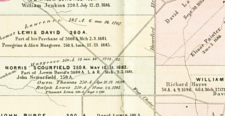
The map below shows the area to become Manoa was first part of Lewis David's 3,000 acres which he sold off almost immediately. The "X" of the roads is the intersection of today's Eagle Road and West Chester Pike. The vertical "Haverford Street" laid out in 1687 was never completed.
The map below shows the area to become Manoa was first part of Lewis David's 3,000 acres which he sold off almost immediately. The "X" of the roads is the intersection of today's Eagle Road and West Chester Pike. The vertical "Haverford Street" laid out in 1687 was never completed.
William Bittle
William Bittle does not figure in the Penn land grants on the map above, but he was one of the earliest settlers of the area that would become Manoa. Information on Bittle is incomplete. Any contributions would be appreciated.
Early References.
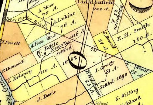
While Bittle is not shown on the land grant map as seen above, the 1810 Hill's Map indicates that his land was settled in 1682. It should also be noted that there is no Bittle found on the first census of 1790.
While Bittle is not shown on the land grant map as seen above, the 1810 Hill's Map indicates that his land was settled in 1682. It should also be noted that there is no Bittle found on the first census of 1790.
William Bittle
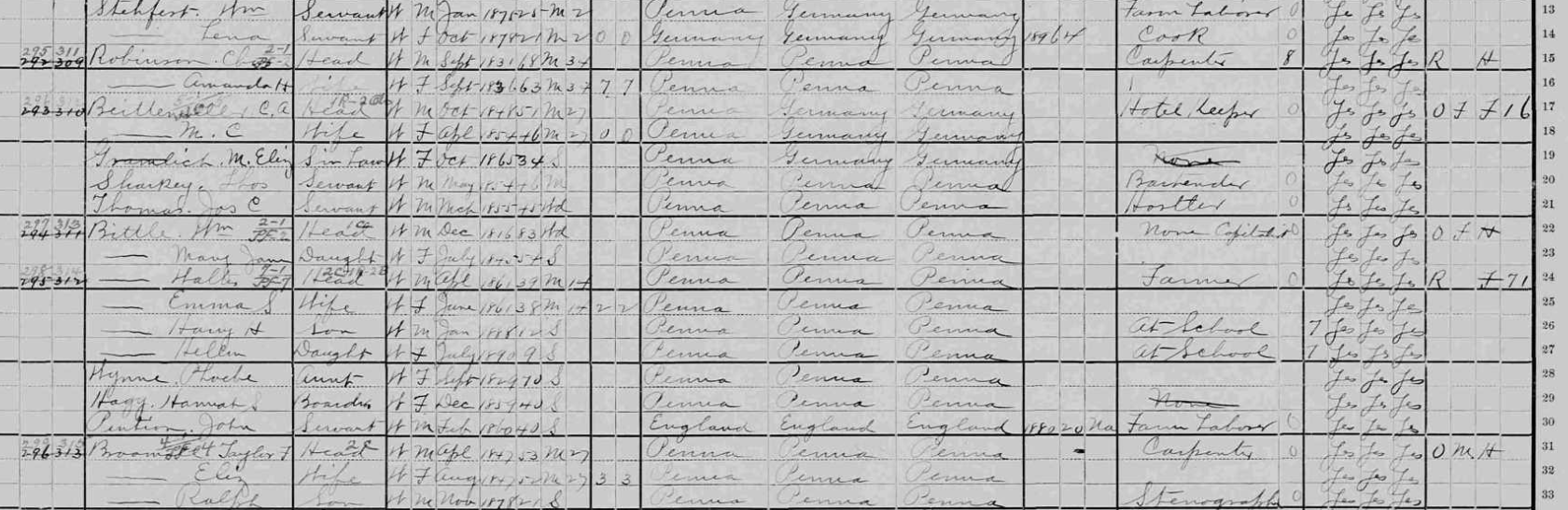
1800 Census
1800 Census
1890 Census
|
Bittle Early Records
Reading old documents. "F" and "S."
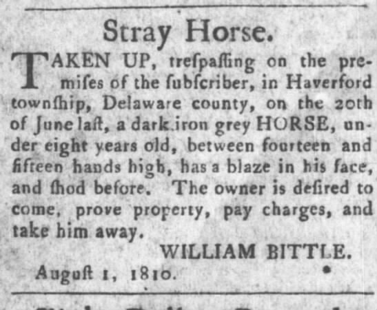
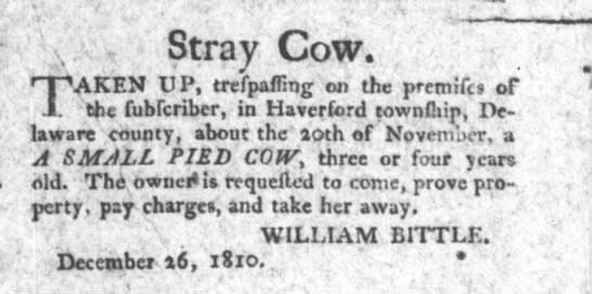
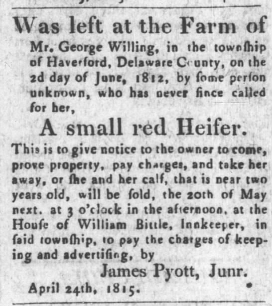
F= S, Please note that in early documents the letter that may appear to be an "f" is an "s.'' Thus. what looks like "trefaffing" is "trespassing."
F= S, Please note that in early documents the letter that may appear to be an "f" is an "s.'' Thus. what looks like "trefaffing" is "trespassing."
U.S. Arms Tavern
As can be seen on the 1810 map, William Bittle was also owner of the "U.S. Arms Tavern." To date, no information has been found for that tavern. The above notices suggest that it may have been an inn. The map also notes that it was settled in 1682. Other documents, however, do not show a Bittle in that area.
oThe William Bittle of the 1900 Census is listed as having "none" as profession but as a "capitalist."
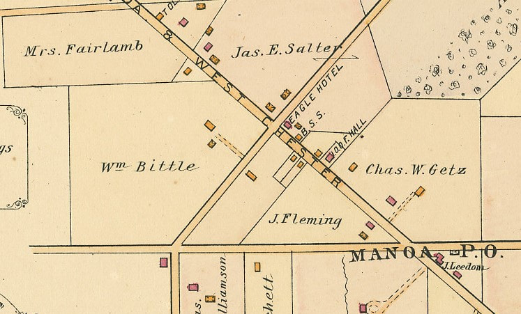
1902
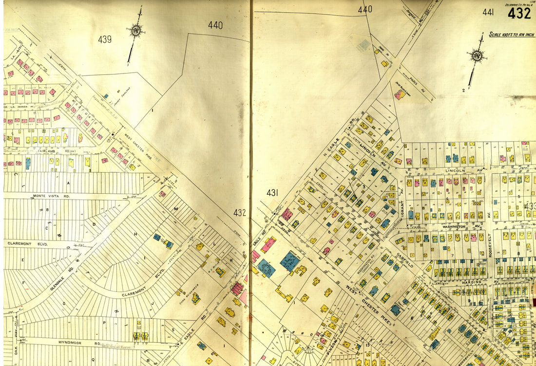
The 1902 map shows two Bittle properties. One is directly in Eagle Road. This house must have been demolished when the present housing blocs were built.
The other, just above, would be the present house which still stands.
The other, just above, would be the present house which still stands.
1910 Census
The 1910 Census lists Walter Bittle's profession as "Gentleman."
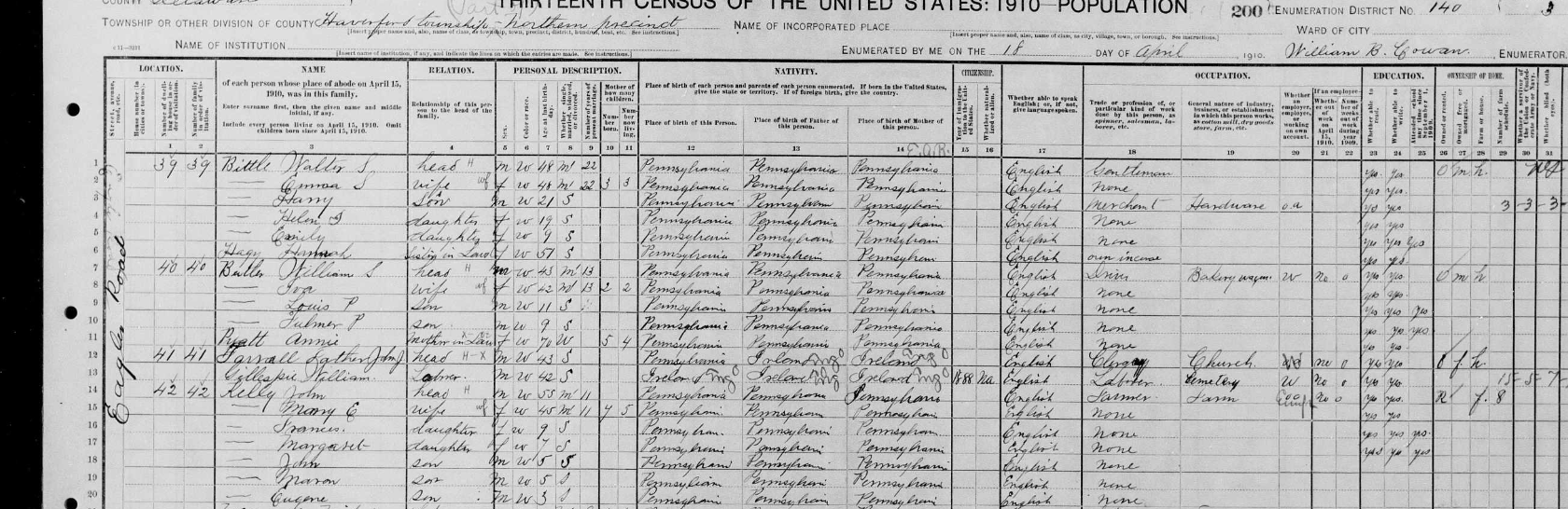
Walter Bittle.
The 1910 census and the 1909 period map shows a Walter Bittle house on Eagle Road. That house would have been demolished. probably when the current block was built.
There is, however, another Bittle house on Bittle Avenue, (see the blue square just below the "E" of Eagle.) the current Claremont Boulevard. This would be the present house.
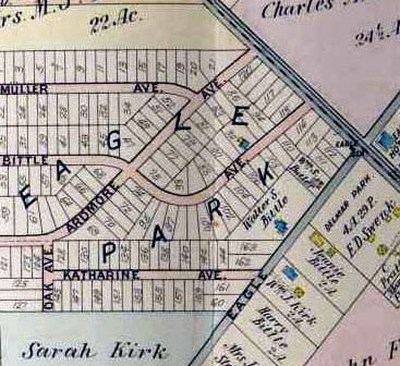
The Bittle House
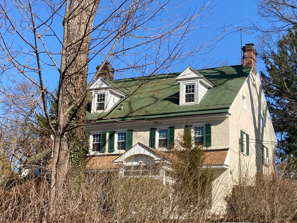
Consider the map above. There is a Bittle property on the lower left of Eagle Road. That house has been demolished and replaced by multi dwellings. There is another property just above and to the left, This property may well be the still standing home on Claremont Boulevard. On earlier maps this road is called "Bittle Avenue." The road is certainly not a "boulevard."
From The Historic Resources Survey of 1994
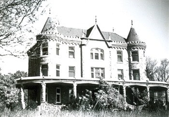
2½ story stucco over stone section with present off-center 'main entrance and door hood built in 1825~ Datestone very eroded but appears to read "WWD 1825". l½ story kitchen wing may be older. (Mr. Podson dates it 1796.) Has unusual built-in corner cupboard, large fireplace with original mantel and winder stairs. 1820' s section has gouged mantel in living room, turn of the century kitchen. Original flooring & beams-1 story west addition later. Glass walls have been added to form enclosed porches. Brick chimneys with ornamented caps on gable ends. Tin roof on all sections. outbuildings: wooden Carpenter Gothic gazebo, carriage house now garage, 20th century wooden shed.
The Eckfeldts
The Family History
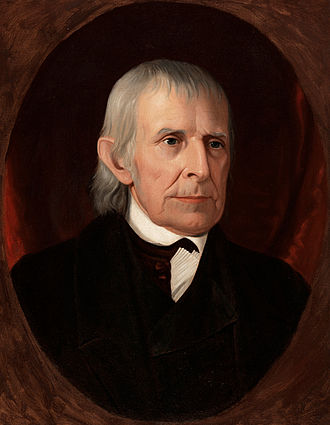
John Adam Eckfeldt (June 15, 1769 – February 6, 1852) was a worker and official during the first years of the United States Mint. A lifelong Philadelphian, Eckfeldt served as the second chief coiner of the Mint, from 1814 until 1839. (see Wikipedia)
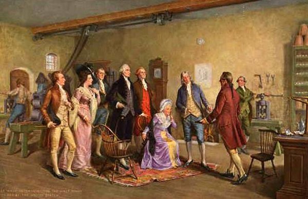
Inspecting the First Coins by John Dunsmore. Eckfeldt is dressed in blue, just to the right of the seated Martha Washington.
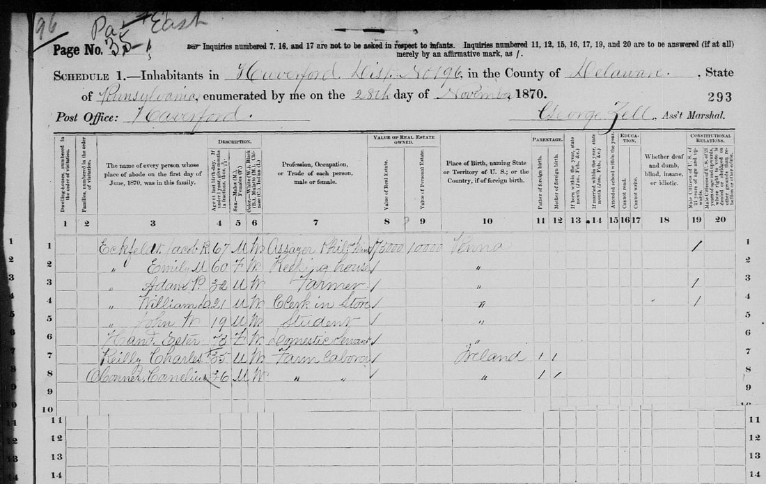
1870 Census
The 1870 census and newspaper accounts of the time tell us that the Eckfeldts were a most prosperous and notable family: three generations who worked at the Philadelphia Mint. In this family the farm laborers are Irish immigrants.

Three Generations at the Philadelphia Mint
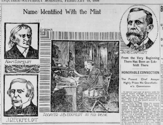
February 19, 1898
|
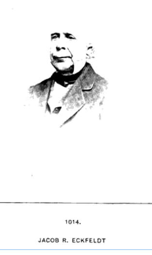
Jacob Eckfeldt
1846 - 1938
|
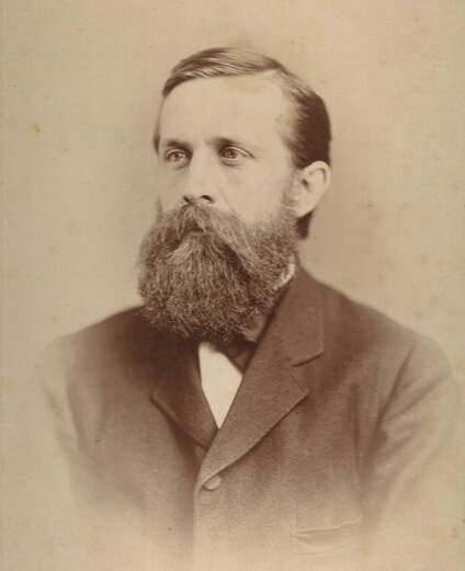
John W. Eckfeldt, Physician, Local Historian.
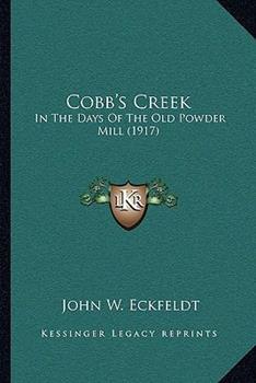
Cobbs Creek in the Days of the Old Powder Mills
read online: Cobb's Creek in the days of the old powder mill : Eckfeldt, John W., 1851- : Free Download, Borrow, and Streaming : Internet Archive
read online: Cobb's Creek in the days of the old powder mill : Eckfeldt, John W., 1851- : Free Download, Borrow, and Streaming : Internet Archive
1868
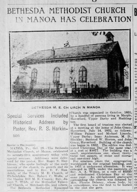
The Spread Eagle Hotel and the Methodist Church
The Barnes map shows the "Eagle Hotel." To the left is "M.E. Ch" (Methodist Episcopal Church) and a cross. The church, now is disrepair, still stand. Just above the church marker is "Bittle." There is a toll house on the Coopertown Road, today's Darby Road. Naylor's Run crosses the present Manoa Road. The name "Manoa" is not yet present.
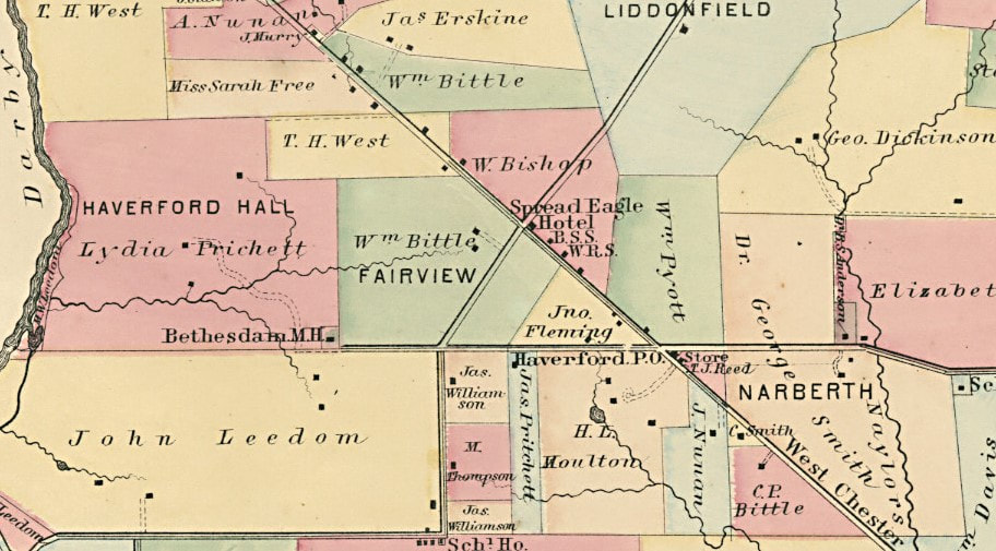
1870
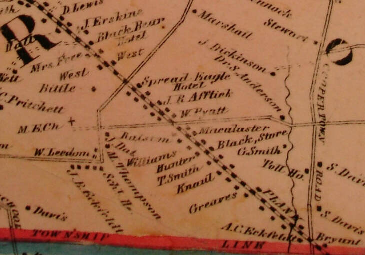
The Haverford Township Atlas shows The Spread Eagle Hotel. At the intersection of West Chester Pike and what is now Manoa Road is he Haverford Post Office. It is also curious to note that the area which will become Llanerch is a farm called Narberth. The estate of William Bittle, "Fairview," is clearly laid out.
The Haverford Township Atlas shows The Spread Eagle Hotel. At the intersection of West Chester Pike and what is now Manoa Road is he Haverford Post Office. It is also curious to note that the area which will become Llanerch is a farm called Narberth. The estate of William Bittle, "Fairview," is clearly laid out.
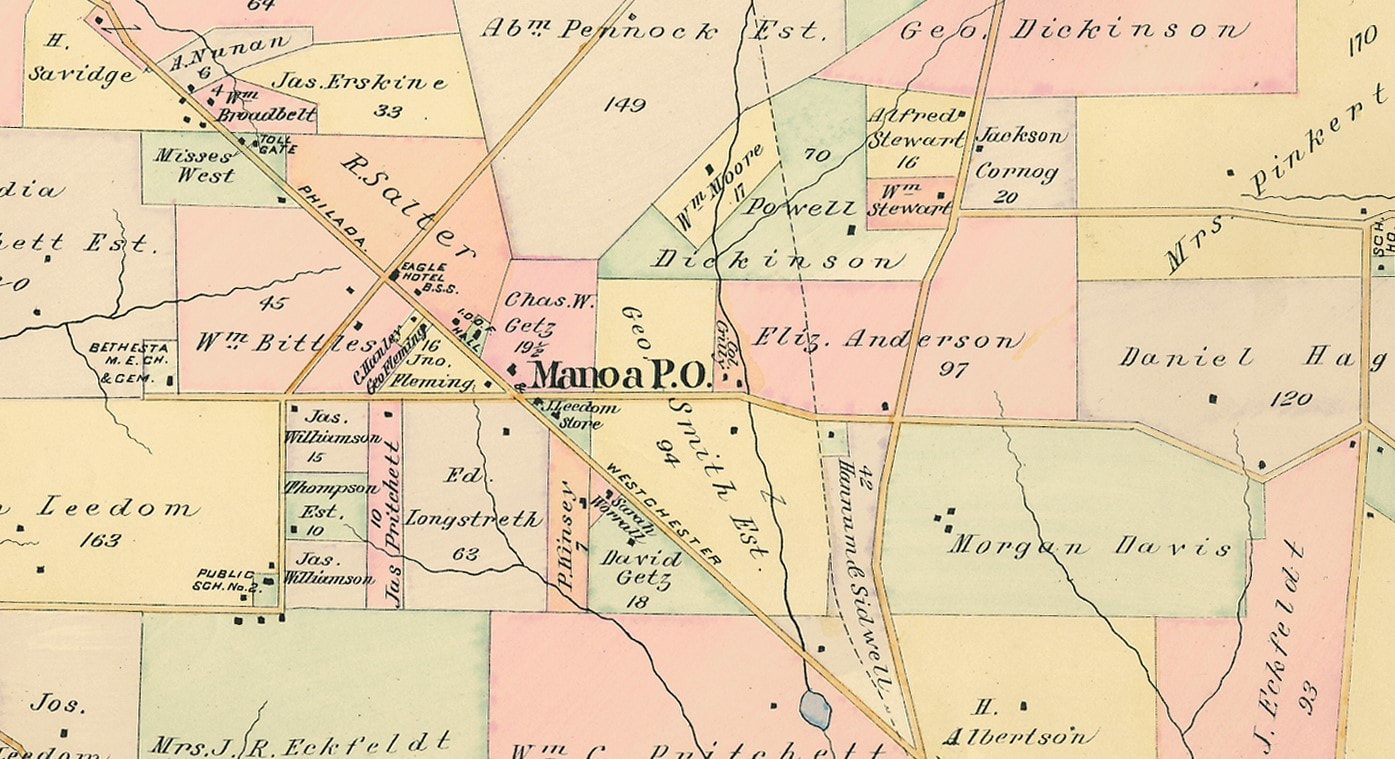
1892
This Haverford Map may be the first time we find the name Manoa. Manoa is noted as a post office at the juncture of what will be called Manoa Road and the Philadelphia -West Chester Pike. It would appear that the store was owned by a member of the Leedom family, one of the most prominent families of the time. An all but forgotten historic site is the "Bethesta M. E. Church and Cemetery" The church later became an Odd Fellows Hall which on this map is just below teh Eagle Hotel. The church is now in disrepair and the graves are neglected.
This Haverford Map may be the first time we find the name Manoa. Manoa is noted as a post office at the juncture of what will be called Manoa Road and the Philadelphia -West Chester Pike. It would appear that the store was owned by a member of the Leedom family, one of the most prominent families of the time. An all but forgotten historic site is the "Bethesta M. E. Church and Cemetery" The church later became an Odd Fellows Hall which on this map is just below teh Eagle Hotel. The church is now in disrepair and the graves are neglected.
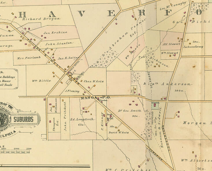
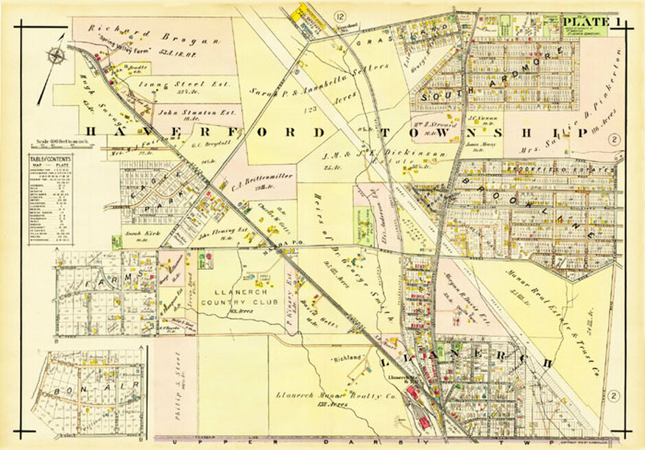
1902
We still find the Eagle Hotel at the intersection of West Chester Pike and the current Eagle Road. The Monoa Post Office is clearly marked. Down Manoa Road just before the intersection of Coopertown Road (later called Darby Road) stands the Manoa School.
We still find the Eagle Hotel at the intersection of West Chester Pike and the current Eagle Road. The Monoa Post Office is clearly marked. Down Manoa Road just before the intersection of Coopertown Road (later called Darby Road) stands the Manoa School.
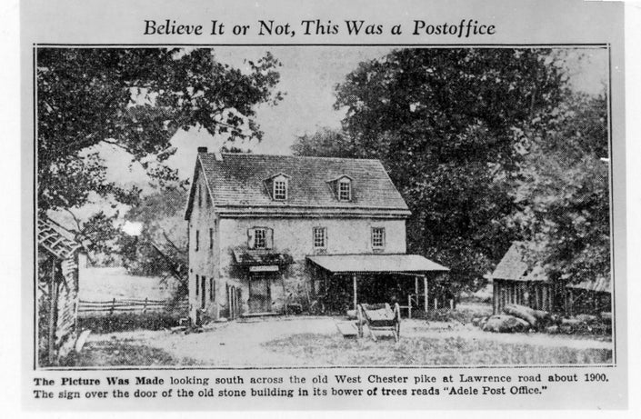
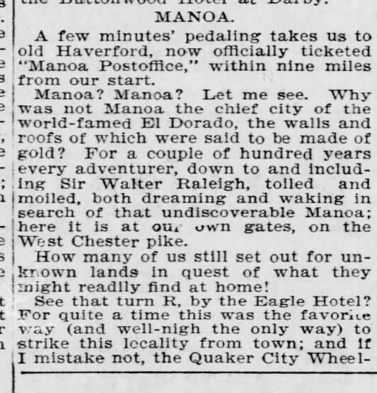
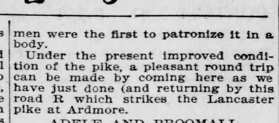
Adele Post Office c.1900
In the News
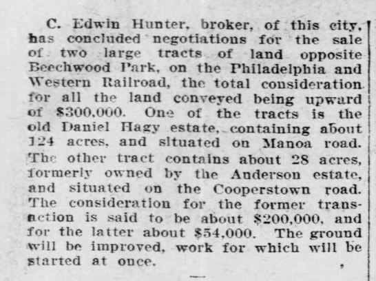
1907
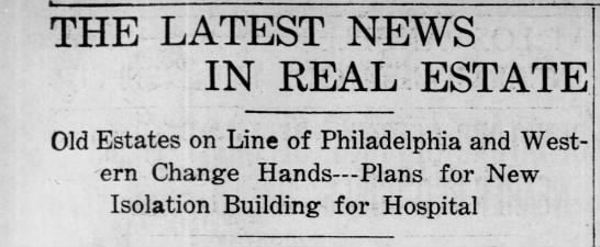
May 13, 1907
The Eckfeldts
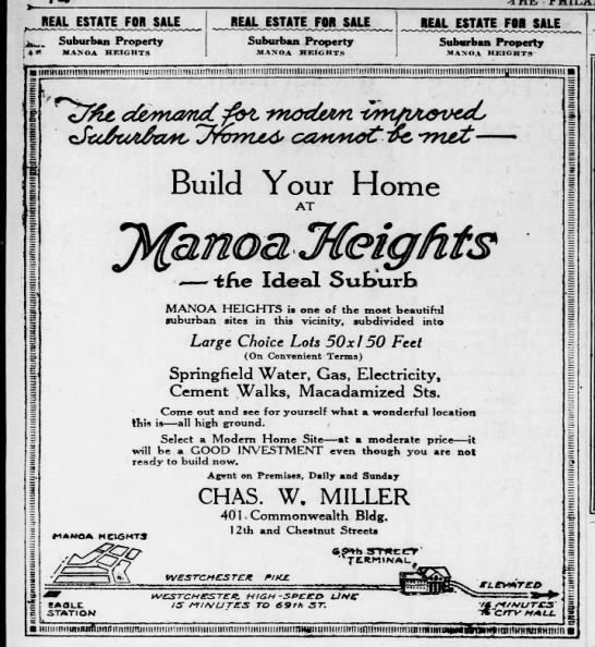
Manoa Heights
Finding information on the development of homes in Manoa is challenging. Unlike Brookline and Beechwood, there are very few advertisements for Manoa.
September 19, 1920


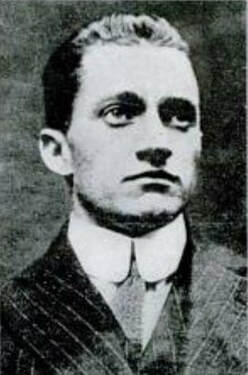
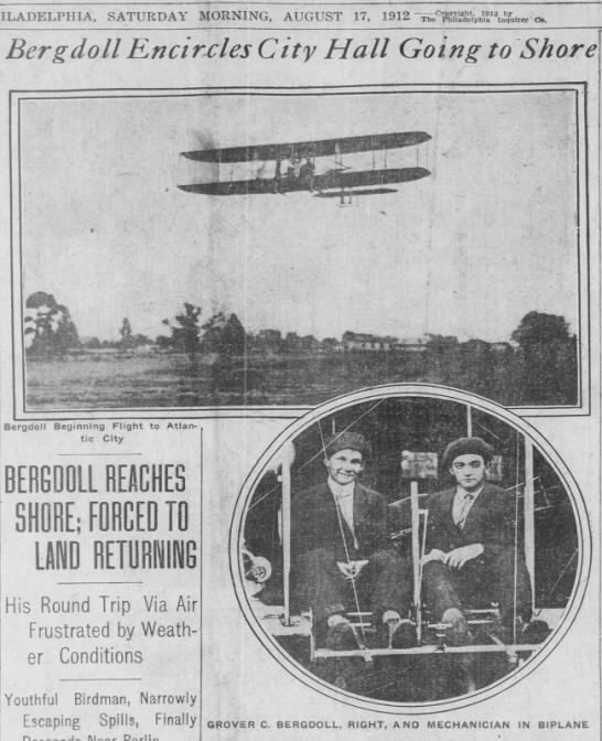
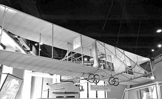
Bergdoll's "Wanted" Poster
|
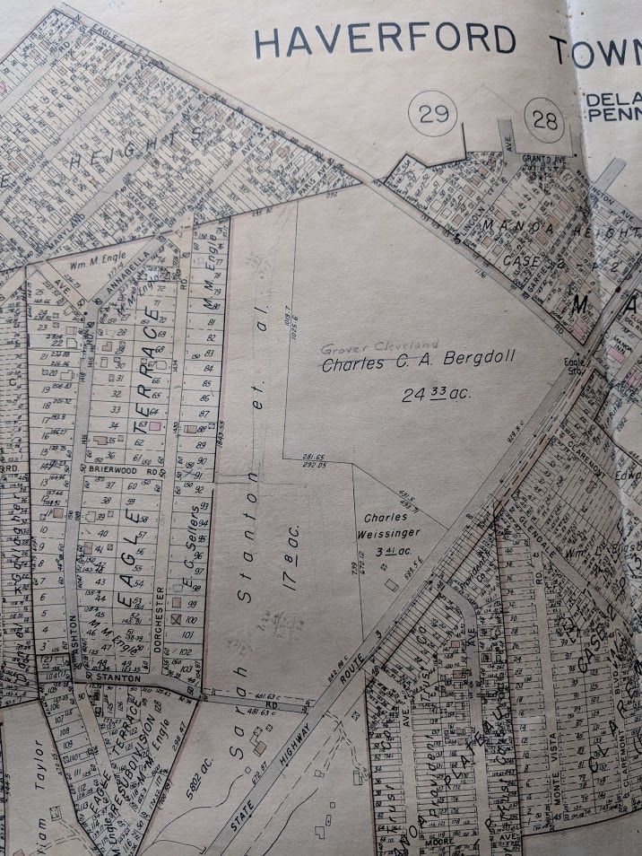
Grover Cleveland Bergdoll
|
Blue Route and West Chester Pike
1906 - 1976
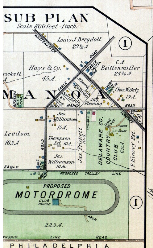
1908 - The Proposed "Motordrome."
1940 - The houses in the "Presidents" streets.
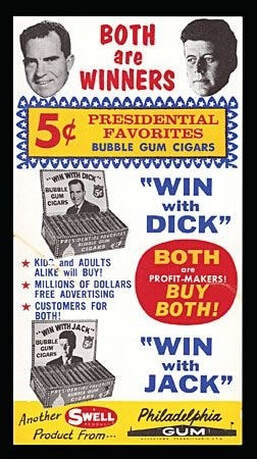
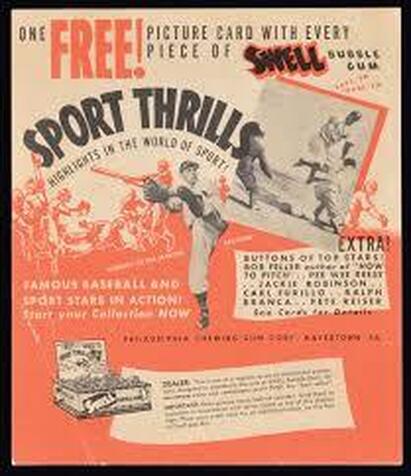
SWELL Bubble Gum
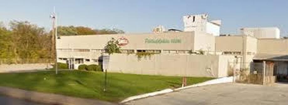
The Philadelphia Chewing Gum Corporation (Swell) built the Manoa Road plant in 1948. The company produced various gum products and was especially known for gum packs with baseball cards. The plant closed in 2003. The plant was demolished in 2011. The site is now occupied by the Haverford Y.
|
|
The Train Line
A branch of the Philadelphia and Delaware County Railroad served the Gum factory and Lobb's Lumber Yard. The tracks are now a walking path. The area has also been cited for polluted and contaminated soil.
A branch of the Philadelphia and Delaware County Railroad served the Gum factory and Lobb's Lumber Yard. The tracks are now a walking path. The area has also been cited for polluted and contaminated soil.
The Philadelphia and Delaware County Railroad